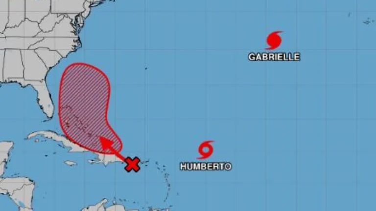

Tropical Storm Imelda is expected to form from a developing system near the Bahamas and could intensify into a hurricane as it approaches the Southeast U.S. early next week, bringing a high risk of flooding rain, coastal surge, dangerous surf, and damaging winds from Georgia through the Carolinas. Forecast guidance highlights three plausible tracks—out to sea, stalling just offshore with days of heavy rain, or a direct landfall on the Carolina or Georgia coast—with the greatest concern focused on slow-moving, training rain bands that could overwhelm saturated soils and river basins.
The National Hurricane Center has classified the disturbance as Potential Tropical Cyclone Nine to enable coastal watches and warnings in advance of impacts, with tropical storm warnings already issued for parts of the central Bahamas and a watch for the northwest Bahamas as the system organizes. Confidence is rising that it will become Tropical Storm Imelda by late weekend, with limited lead time for residents along the Southeast to complete preparations before the first hazards arrive as early as Monday.
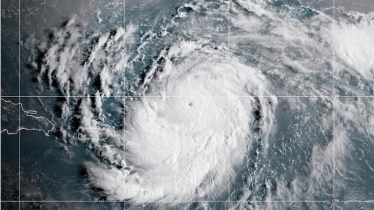
Imelda’s evolution is unfolding alongside Hurricane Humberto in the western Atlantic, an unusual two-storm setup that could alter Imelda’s track and timing through atmospheric interaction, potentially via the Fujiwhara effect. While Humberto is projected to remain offshore and pose the larger threat to Bermuda rather than the U.S., its circulation may still nudge or tug Imelda’s path, affecting whether the system turns out to sea, lingers near the coast, or presses inland.
Economic Times reporting underscores the risk corridor from Florida’s northeast coast through Georgia and the Carolinas, noting forecasts that call for life-threatening storm surge in vulnerable coastal zones if Imelda strengthens and tracks close to shore. Additional coverage flags that heavy rain and flash flooding are plausible even without a direct landfall due to persistent onshore flow, coastal convergence, and the possibility of the storm stalling near a coastal frontal boundary.
The central hazard signature with Imelda is freshwater flooding: meteorologists warn that stalled bands could deliver extreme rainfall totals in a short window, with scenario planning including locally 2 feet of rain in the worst case for parts of the Carolinas. Even more modest outcomes featuring 4 to 8 inches would be disruptive given saturated antecedent conditions, raising flood and river rise risk across coastal plains and into the southern Mid-Atlantic.
Authorities and forecasters urge closely monitoring official advisories this weekend as the forecast cone and intensity projections sharpen, given the narrow preparation window and the potential for rapid changes from storm-storm interactions. Emergency management offices in at-risk states have begun preparedness messaging, emphasizing readiness for surge, inland flooding, rip currents, and gusty winds, with evacuation decisions dependent on the storm’s final approach and timing.