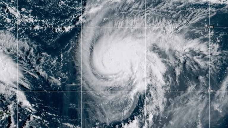


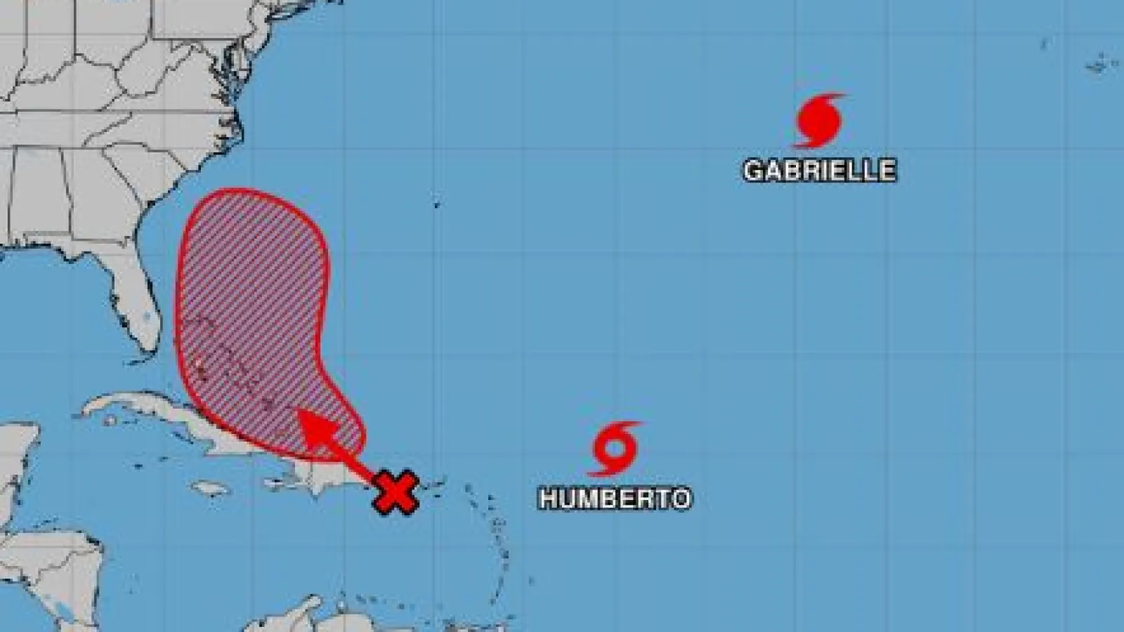
Atlantic Ocean – Tropical Storm Humberto continues to spin across the central Atlantic, but U.S. forecasters warn that the real concern may be what’s forming right behind it.
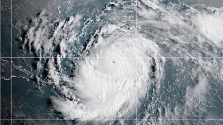
A tropical disturbance moving through the northern Caribbean is already bringing heavy rainfall and flash flooding to Puerto Rico, the U.S. Virgin Islands, and Hispaniola. Meteorologists at the National Hurricane Center (NHC) say this system has a high probability of developing into the next named storm before the weekend.
What makes the forecast particularly challenging is the potential interaction between Humberto and this Caribbean system.
-
If the disturbance remains weak, Humberto’s circulation could steer it harmlessly out to sea, sparing the U.S. mainland.
-
But if it strengthens over the warm waters of the Caribbean, the storm could resist Humberto’s pull and take a more westward path, raising concerns for the U.S. East Coast.
Forecasters note that several factors will determine the outcome: Humberto’s intensity, its size, and the proximity between the two systems.
Localized Perspective: What U.S. Residents Should Know
-
East Coast Vigilance: From Florida to the Carolinas, residents should keep a close eye on storm updates over the next 5–7 days.
-
Preparedness Matters: Even if the storms stay offshore, rip currents, coastal flooding, and heavy surf are likely along the Atlantic seaboard.
-
Caribbean Impact: U.S. territories such as Puerto Rico and the Virgin Islands are already experiencing flooding, highlighting the need for swift disaster readiness.
Some Questions:
-
Will Tropical Storm Humberto hit the U.S.?
Current models suggest Humberto may stay offshore, but a new Caribbean system could shift the forecast.
-
Which U.S. states are at risk?
Florida through the Mid-Atlantic should monitor updates, especially if the Caribbean storm strengthens.
-
What should residents do now?
Stay alert, review emergency plans, and follow guidance from the National Hurricane Center.